


The main challenge of generating a consistent and accurate map of the urban environment is building a reliable baseline vehicle trajectory. This is particularly difficult for complex urban environments such as metropolitan areas due to multi-lane roads, GPS blocking from high-rise buildings, and abundant dynamic objects and pedestrians. The core algorithm relies on Simultaneous Localization and Mapping (SLAM) technique in order to garner sensor data from a multi-modal platform and optimize the final trajectory.
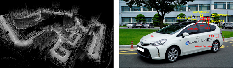
The overall dataset includes a fully multi-modal phase for the robotics researchers. The environment covers mid-side downtown areas to the highly complex Gangnam district of Seoul. A typical residential form, a large group of a building complexes, is also introduced in the dataset. All of the abovementioned areas address the sporadic GPS reception issue, which was alleviated by Prof Kim’s research.
Prof. Ayoung Kim (Department of Civil and Environmental Engineering)
Homepage: http://irap.kaist.ac.kr
